West
End Traffic Pollution: 08:34:52 09-06-2026
Please note that this is an emulation
and does not show real live data.
|
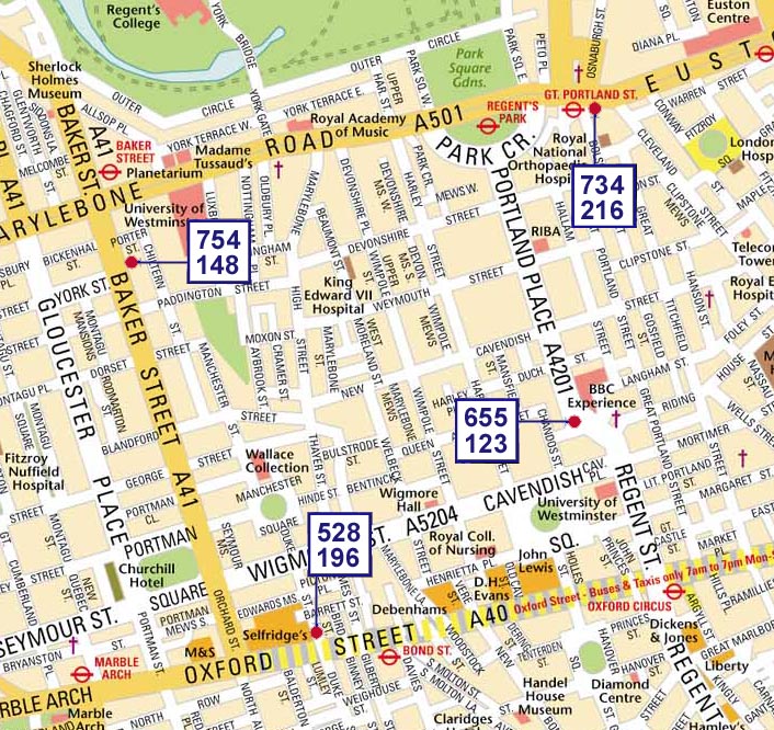
Source Data Source data is collected from four 24-hr realtime monitoring points as indicated. Top
Figure is the Carbon Monoxide level at that point. CO is a
general measure of exhaust concentrations in any local area. Sensors
at Jan 2003: Gt Portland St - Tube Station Portland
Place - BBC Broadcasting House |
| Disclaimer: Cats Eye Networks provide real-time streamed data "as is". While we always endeavour to provide accurate data and will carry out continous quality assessments on our data streams we cannot be held liable for any action whatsoever taken by users of this data and no warranties or guarantees are offered in any way as to its accuracy. |
Mapping by Oxford Cartographers
Technology by